Dean &
Ginny's excellent adventures... Main
Adventure Page
Road
Trip
to the SW Desert--04/07:
<<
Part 1
<<
Part
2 Part
3
Part 4 >>
|
|
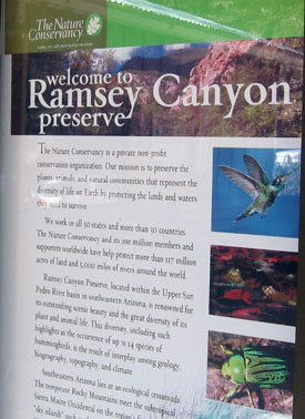
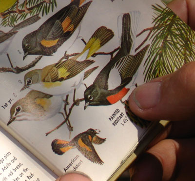
<< Ramsey Canyon,
a well-known birding area, backs into a national forest area at the top of the ridge.
It was purchased by the Nature Conservancy.
There was limited parking so we hung out at a fine arts center nearby
until the morning crowd started leaving.

|
|
|


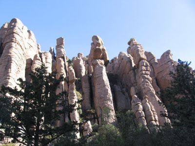
The
next morning we took off for Apache country,
the Chiricahua National Monument.
|
It was a great hike up to the top of the canyon and we
checked off some new birds for us. Birders are early risers, but
coming in the middle of the day (after Bisbee) meant that we had the whole
preserve to ourselves.
|
|


|

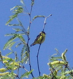
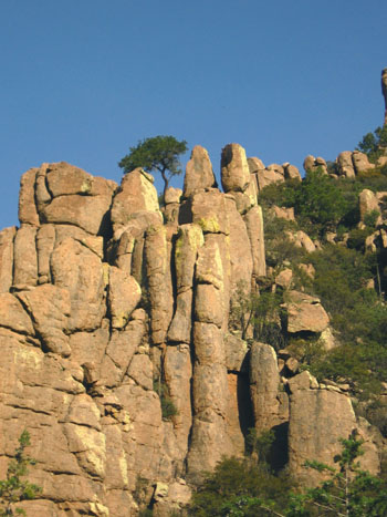
<< We got an early start and
caught the morning light on the rocks and the morning birds like this
Mexican Jay, another first for us.


Apaches lived in this region and some say that Cochise's profile has been
captured in these rocks (above), and that his presence is still felt here
today. |
|
|
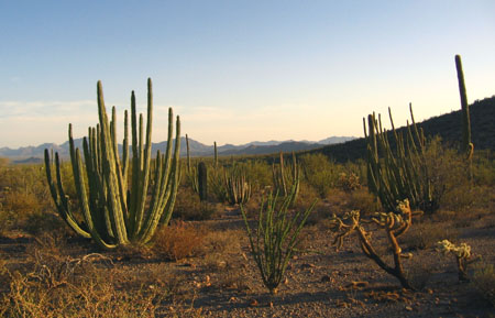
Then we headed west again, a fairly long drive
to the Organ Pipe Cactus National Monument. Here there are
26 species of cacti and a large collection of desert
animals. In 1976, the United Nations also designated this
area as an International Biosphere Reserve. It sits right
on the southern border of Arizona and there is a port of entry
into Mexico on the one road through the park. We arrived
in the late afternoon and took a hike up the vista trail.
Good views across to Mexico. The Organ Pipe cacti have
many vertical branches--making it look like a pipe organ, maybe. |
|

|
|
 |
 |
|
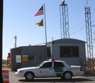
The next morning we left before dawn on
our way to Boyce Thompson Arboretum. We were
traveling well within the speed limit, but it wasn't long
before we were pulled over. The Border Patrol
thought that a van traveling before dawn was suspicious,
because the port was not open yet. There are
various permanent installations on the roads away from
ports of entry that stop all traffic, but this is the
first time we've been stopped like this.
The Boyce Thompson Arboretum is in
Superior, AZ east of Phoenix. Colonel Thompson
amassed this large chunk of land--320 acres-- that he used
for educating people about plants and gardening. The
arboretum is now part of the University of Arizona and has
been declared by The Audubon Society as an important bird sanctuary.
We loved the demonstration gardens, the wide array of
birds, the walks throughout the property, and the historic
structures. We had a wonderful morning. |
|
|
|


|
<< The
colors in the gardens were fabulous. There were instructive
signs all around, not only identifying the flowers, but explaining
how to create gardens like this. They also sold plants.
Hey I could have bought a saguaro cactus for $8.95--lets see,
probably only 97 years until it gets its first arms.

<< This
settlers' house, for a family of five, is built into the rock face. Covered with
vines, it was cool inside. Out front is the large herb
garden.
|
|

|
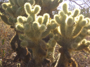
<< The herb
garden. Below is the "teddy bear" cholla cactus, but it only
"looks" cuddly.
|
|
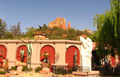
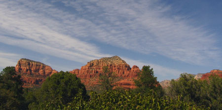
After we left the arboretum, we headed north
toward Sedona. We could see it coming from miles
away--those large red rocks, oh my.
|

|

|
There was a park with bikable trails
around bell rock. We biked up the trail for a while,
but turned around when it became too rough. Lots of
people were out enjoying, and even climbing on, the
rocks.

|
|
|
|
 After
going through town with its artsy galleries and restaurants,
the road becomes narrow as it twists through a twenty-mile +
gorge up to Flagstaff, AZ. We stayed in a cabin at a
recreation area near there. After
going through town with its artsy galleries and restaurants,
the road becomes narrow as it twists through a twenty-mile +
gorge up to Flagstaff, AZ. We stayed in a cabin at a
recreation area near there.
We continued north through the Painted
Desert. The green of the golf course contrasts with
the rocks.
|
|

Then we drove past Lake Powell. It's
created by this dam, but it looks like it could be 60 or 80
feet low.
We'd been in some of this area two years
ago,
but of course in the spring it's different. This time we went on
the northern route along the Vermillion Cliffs.
And on to Zion National Park. We
arrived late and there was no room in the park campgrounds, so we camped just
outside the park in a commercial campground for one night and watched the rain close in
on us. |
|
|
|
Zion National Park >>
Main
Adventure Page
|
|
Top of page:
|