Dean & Ginny's excellent adventures...  Main Adventure Page

Panama Cruise--2012: << Part 1 Part 2 Part 3 >>  Part 4 >> Part 5 >> Part 6 >> Part 7 >> Part 8 >> 
Part 9 >> Part 10 >> Part 11 >> Part 12 >>

   The Panama Canal !!

Our day began early because the ship was scheduled to start its transit at 6am. Getting up early is not a problem for us, but we were a little surprised to see how many of our fellow passengers were up for the viewing. But then this passage is the signature event of the cruise. Most people are traveling only for two weeks and will have no other chance to see this.

We learned about some of the messy history of the canal building and some of the many problems encountered on so many levels. The Suez Canal had already been built, so some people didn't think it would be too hard, but digging through the sandy desert is not the same as going through a rocky mountain range.
 
One of the ways to make it easier was to dam the Chagres River so they wouldn't have to dig so deep through the mountains. For many decades the resulting Gatun Lake was the largest manmade lake in the world. (Now there is a larger one in China.) The Canal was finally opened in 1914, just as World War I began.

So we begin our journey through the canal by going through the three Gatun Locks which will raise us up 85 feet. 

 
As the sun rose, we watched with many of our fellow passengers as our tugs greeted us and were ready to help nudge us into the first lock. 

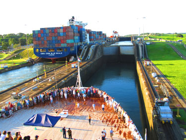
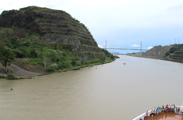
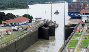
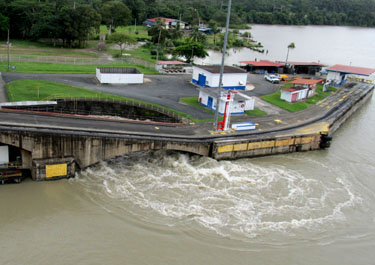
As we approach the first (lowest) lock, we can see the single lane bridge for vehicle and pedestrian traffic from one side of the canal to the other. The ships have the right of way, so the vehicles are limited to times when the lower gates are closed--first one way and then the other. You can see the cars and buses lined up on the right waiting their turn.


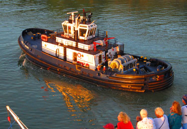
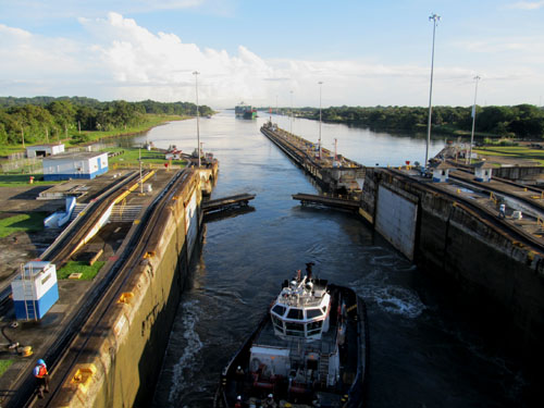
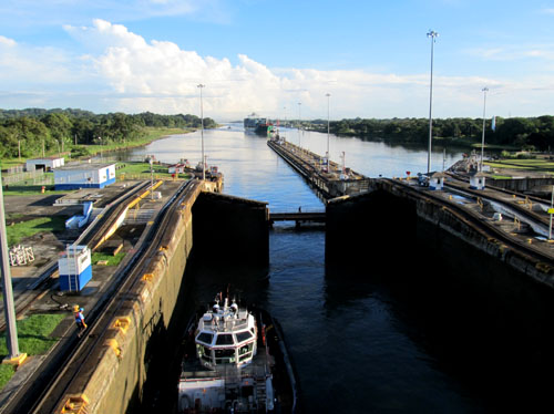
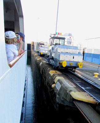
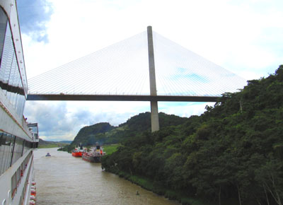
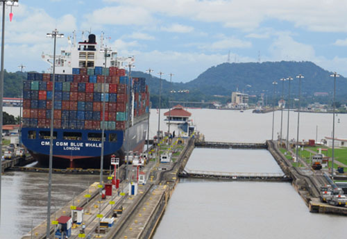
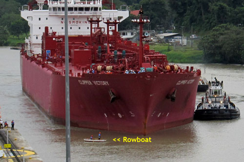
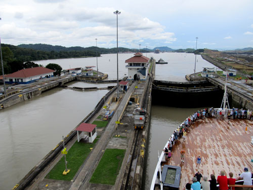
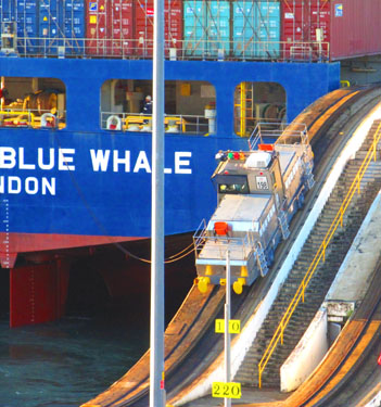
Looking forward as we enter the lock, our three starboard electric mules wait for our lines. There are three mules on each side with two toward the bow and one at the stern. There is not much spare room for our ship. (It's called a Panamax ship because they don't take ships any wider.) The mules' function is to keep a perfect tension between the two sides so we don't hit the sides of the locks. We move under our own power, though. 

A fully-loaded cargo ship, the CMA CGM Blue Whale from London, is ahead of us in the left-hand set of locks. We would follow the Blue Whale for the next eight hours.  Looking behind our ship (See below.), one tug enters our lock and the single lane bridge closes behind it. Then the back doors of the lock close. 

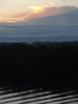
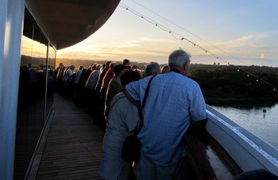
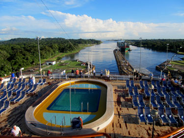
While we were paying close attention to the locks and all the activity surrounding their operations, once in a while we'd look at the broader view. It was a a beautiful day and the view from a higher deck looking back over the aft pool. There was a dense jungle on either side.


As we pull into the first lock, you can see the front two mules on the starboard side from a lower deck and then you can see the first mule after it had ascended the steep incline to the top of the second set of gates from a higher deck. Yes, we ran all over the ship to give you the best account of the whole process. Now, we'll sit here while the water from Gatun Lake bubbles up from the bottom. There are no pumps moving water into or out of the locks--the whole operation relies on gravity. It takes about ten minutes to bring the level up even with the second lock.


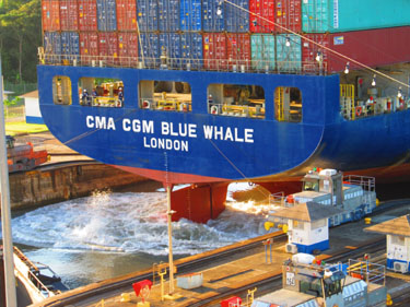
Meanwhile, the Blue Whale is ready to move to the third lock on its side. Its back mule climbs the steep incline and then you can see the water churning as it moves forward under its own power.


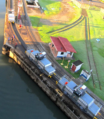
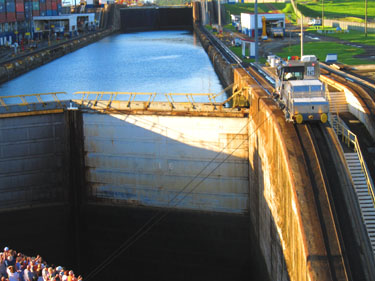
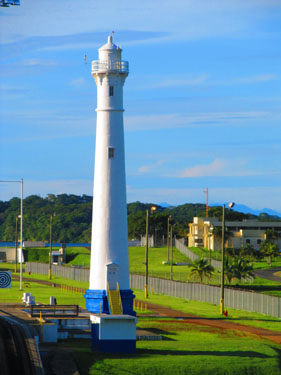
When the gates close, railings pop up and workers can cross from one side to the other.  Warning bells ring as the gate is about to open. As we reach the Gatun control tower at the beginning of the second lock, one mule is returning through arched opening in the center, while our lead port mule is climbing its steep section up to the second lock. Also a lighthouse stands to our right as we pass through. 

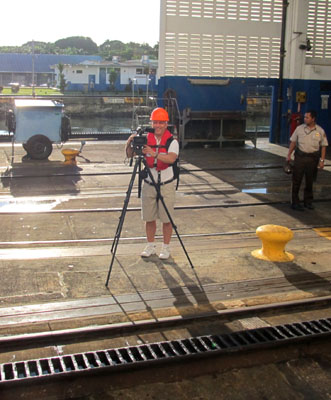
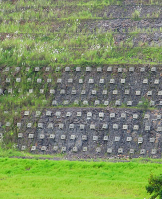
Ship photographers stepped ashore during our passage through the three Gatun locks to record our passage for the cruise video and for still photos. In front of the photographer you can see the close-up of the cogs between the mules' tracks--these are most needed for the steep inclines so they don't lose ground.  The Gatun headquarters and welcome sign is on the incline of the third lock. After we're through the third lock we are in Gatun Lake.

Looking to our right as we enter the lake, we can see the huge earthen dam with a concrete spillway into the Chagres River. 


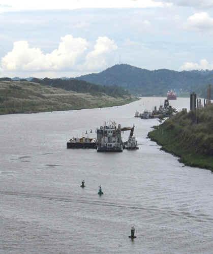
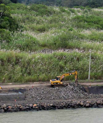
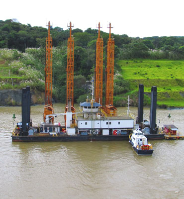
When we look back to the left, we see all the cranes where a third and larger set of locks are being constructed. With everything we know now, it will be much faster than the first time around, but considering all the original problems, the old locks work extremely well. Our tugboat gives itself a freshwater shower in the lake.

As we look straight ahead there are several ships at anchor. Some are on a northward route and are waiting until the morning southbound ships are out of the locks, while others did not know their schedule in advance and are waiting for an open slot. The locks operate around the clock now since lights were installed in the 1960s.


Because this had been a mountainous region, the tops of the peaks became islands--lots of them. The ships have a circuitous route to follow between the islands and have these targets to line up as they set a course for each leg of the trip. If they are traveling in a one-way convoy, they use the crosses, but if there is traffic in both directions, they need to use the vertical lines. It's been 100 years since this lake was built and the islands and the shorelines look pretty much like natural waterfront lands now.

There are many remnants of past work on the canal as you can see next to this local boat. We could see some old boat wrecks, which are now covered with vegetation.


We saw some birds and a few butterflies. This skipper butterfly clung to the outside of the window in the pool area--you can see the reflections of the chairs and tables. The black vultures circled overhead.

As we reach the far side of the lake, we come to the Culebra Cut through the continental divide--better known as the big ditch.  This is where most of the original construction problems occurred. 

Even today it's an ongoing struggle to maintain the canal through this region. There's bank stabilization to control erosion, and various types of dredging--from backhoes to suction.

As we go through the Big Ditch, we see Gold Mountain on the left and the Pan-American Bridge ahead of us. Gold has never been found in or around Gold Mountain, but it was so named to entice workers to come and dig through it. It has been topped twice, reinforced with tiebacks, and stepped back to keep it from collapsing into the canal.


Here is a close-up of all the tiebacks that have been inserted into Gold Mountain and a look back at the beautiful Pan-American Bridge. And then we approach the first of the locks on the southern end of the canal, which will bring us back down to sea level.


As we enter the Pedro Miguel Lock, we see the Blue Whale again. From this vantage point it doesn't look like there is very much difference in altitude down to the Miraflores Lake, but indeed there's a 30-foot drop.  This lake is much smaller and we can see the next set of locks directly in front of our lock. Two workers in a rowboat bring our three mule cables out to our ship.


As the Blue Whale exits into the lake, the lock gates close and as we look back The Clipper Victory, a large tanker, moves into place following the Blue Whale in the left-hand lock. Here you can see how miniscule the rowboat with the cables looks in comparison to the tanker.


The water level in our lock lowers us down to the level of the Miraflores Lake.


Meanwhile in the lock next to us the tanker moves into its lock and after the gates are closed and then we can see the water rush out from its flume in front of the lock. As we entered Miraflores Lake and headed toward the last two locks, the skies opened up. The pouring rain chased us, and most everyone else, inside. So our trip through the last two locks does not include any photos. Maybe on the trip back the sun will come out...

On the other hand, the annual 25 feet of tropical rain allows the whole lock system to work. Without this huge amount of rainfall Gatun Lake would eventually be drained from all the lock operations. 40 ships a day pass through the canal.

Now we start our trip northward... >>

Main Adventure Page

Top of page:

© Sky-Bolt Enterprises 2001-2012